How data fusion solves tomorrow’s road traffic challenges today

Share the article
As we previously explored, the latest generation of smart transportation technologies are capable of generating significant amounts of data, allowing operators to analyse everything from traffic flows to pollution levels. In this blog, we take a detailed look at how the latest artificial intelligence (AI) and machine learning (ML) algorithms, combined with data fusion techniques, can be used to give greater insights into traffic behaviours and road infrastructure.
Many sectors are seeing digital transformations taking place and closely linked to that is an explosion in the amount of data being collected from sensors, devices, and also connected devices. The transportation sector is no different, with an increasing amount of internet-enabled – or ‘Internet of Things’ – connected technologies being deployed that can collect data about the environment they are deployed in and transfer this over networks for both real-time and historical analysis.
The rapid rise of data collection in smart transportation
In the smart transportation sector, data can be generated from numerous sources including connected and autonomous vehicles (CAVs), roadside traffic sensors including cameras and radar, navigation apps, and even meteorological and pollution sensors.

All this rich data is valuable for those responsible for monitoring road networks and infrastructure, as it provides important insights that can be used to improve critical areas such as congestion, safety and pollution.
With sustainability being the top of the agenda for most governments and non-government organisations (NGOs), this data is crucial when it comes to addressing some of the pressing challenges the world faces, especially decreasing greenhouse gases and reducing deaths and injuries on the road.
What to do with all this data?
Being able to collect and monitor data from sources such as CAVs, cameras and apps will give authorities and operators a much better understanding of how they are meeting targets and improving the roads they manage, especially when it comes to future investments.
Yet while the data collected from one source is valuable, it is often data that is combined and fused from multiple streams that gives true insight into how an asset is performing and provides greater certainty in comparison to single source insights.
Fused data can unlock insights and solutions that were hidden before and assist teams in making better informed, and often quicker, decisions that benefit many stakeholders.
That’s why Valerann – and our expert team of data scientists - is leading the development of the most comprehensive data fusion software tool ever seen for road operators, known as Lanternn by Valerann.
Speaking the same language
Whatever the application for data fusion, one of the key challenges is ensuring that data sources speak the same language, otherwise they cannot fuse together and you do not get the benefits of one holistic image.
For traffic management, it is common that data from sensors speaks one language and is siloed from longitude/latitude data (such as mapping) that speaks another. Bringing these two siloed data sources together is therefore an important step towards greater understanding of road traffic behaviour. And in order to bridge this gap we must translate these coordinate systems, as well as data such as timing, casual relationships and levels of confidence.
With this challenge in mind, Valerann has developed patent-pending fusion algorithms that seamlessly bring together these disparate data sources. But why is this important?

Unlocking new potential through fusion
Using sensor imagery, road operators can undertake a variety of tasks, including automated hazard detection, traffic flow and trajectory analysis, and stopped vehicles alerts – but cameras often lack the ability to accurately geolocate and this can require very experienced operators.
On the other hand, it is possible to geolocate traffic events on maps, but exact locations and the accuracy of reported events may be low, leading to false alarms and a misallocation of resources.
No single data source is completely accurate, so bringing together and fusing both data sources allows operators to verify events and behaviours more confidently than before. For example, by using Valerann’s fusion algorithms a road operator can automatically detect a stationary vehicle on a highway and accurately geolocate it, which can then be corroborated further in the same software with data coming from navigation apps such as Waze or Google Maps.
This can also be done in reverse, where incidents are detected using mapping software, and corroborated with sensor imagery.
Importantly, these scenarios do not require traffic cameras to be calibrated beforehand as the detection and geolocation is done automatically, easing workload for personnel, and this is even the case with moveable pan-tilt-zoom cameras. This is also image sensor agnostic, meaning that operators can utilise what’s currently deployed on their road networks rather than investing in brand new equipment.
Intelligent selection of sensors
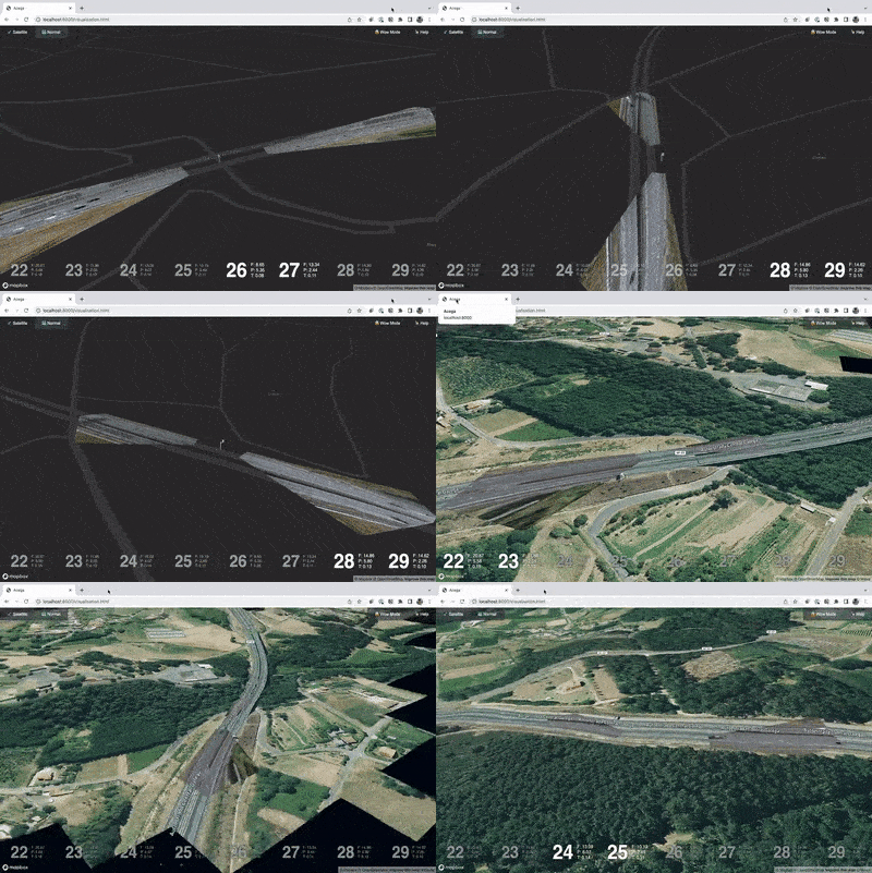
Valerann’s fusion engine also allows the intelligent selection of available cameras on a highway, overlaying camera positions and feeds onto the map interface to give operators a significantly better understanding of where cameras are situated and their visual coverage, including blind spots.
This ensures that the optimum camera is chosen and this therefore enables significantly quicker response times to incidents that might be detected from non-imagery data sources.
Traffic flow patterns and speeds can be monitored from road sensors, which can then be combined with estimated route times in navigation apps to calculate the likelihood of traffic issues. As part of the Lanternn by Valerann user interface (UI), road operators can clearly see where there are issues and because of its fusion capabilities, the software can also automatically assess the risk level for that stretch of road taking into account a number of factors, including weather.
This gives operators a key predictive analysis capability that allows them to mitigate risks before an incident occurs. Using ML algorithms and available historical data, the software is also able to analyse past events and use this to train the data fusion engine to predict future incidents.
This blog only skims the surface of Valerann’s powerful data fusion capabilities and there is much more currently being developed by our data scientists. Here, we have demonstrated the exciting and transformative impact that Lanternn by Valerann will bring to the smart transportation sector. If you would like to learn more, please contact us.

.png)

